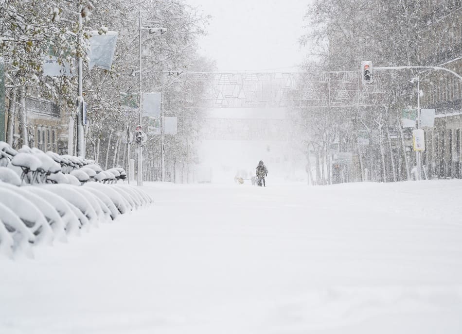
Winter Storm Fern is a large, long-lasting winter storm impacting the United States. Forecast guidance points to destructive ice in the South and heavy snow from the Plains into the Midwest and Northeast. Impacts extend for days. Travel risk is high. Power outage risk is elevated where ice loads build on trees and lines. Many locations face a wintry mix that changes by hour.
Fern is expected to affect more than 230 million people. Heavy snow or significant ice is projected across 34 states. Cold air behind the storm increases the duration of impacts. Refreezing becomes a serious threat after sunset. Recovery can take longer than the storm itself.
Fern is a major U.S. winter storm with multi-day impacts. Ice drives the highest outage risk in the South. Snow totals rise from the southern Rockies and Plains into the Ohio Valley and Northeast. A coastal low may enhance snowfall and wind near the East Coast.
What makes Winter Storm Fern different
Fern combines ice, snow, and a long impact window.
This storm is not a quick-moving clipper. It is widespread and slow enough to stack hazards. Freezing rain creates the highest damage risk. Even one-quarter inch of ice can start rapid escalation in outages and tree damage. Wind adds strain. Snow further north drives closures and impassable roads. Airports see delays when deicing demand spikes.
- Primary hazard in the South: freezing rain and damaging ice
- Primary hazard north and west: heavy snow and drifting
- Compounding factor: arctic air, flash freezes, and slow thaw
Ice forecast and where outages can last
Ice is the most disruptive threat for much of the South and parts of the interior Southeast.
Freezing rain coats bridges first. Then it spreads across untreated roads and secondary routes. Tree limbs fail when ice builds. Lines sag and snap. Restoration takes longer when roads are blocked. Households without power face dangerous indoor cold. Backup heating needs strict safety rules to avoid carbon monoxide risks.
High-risk ice metro areas with official .gov resources
These locations should monitor local emergency updates and winter operations pages.
- Dallas, Texas
- Houston, Texas
- San Antonio, Texas
- Austin, Texas
- Nashville, Tennessee
- Atlanta, Georgia
- Greenville, South Carolina
- Charlotte, North Carolina
- Raleigh, North Carolina
- Knoxville, Tennessee
Snow forecast and where totals can sue
Snow is expected to expand from the southern Rockies and Plains into the Midwest and Northeast.
A broad swath is projected to see at least 6 inches through Monday. Several areas have a meaningful chance of a foot or more. Heavy snow strains road crews and increases crash risk. Snow load increases roof risk for older structures. Blowing snow can drop visibility fast, even when totals are moderate.
Key snow corridor metro areas with official .gov resources
These cities should prepare for slow commutes, closures, and extended cleanup.
- Albuquerque, New Mexico
- Oklahoma City, Oklahoma
- Little Rock, Arkansas
- Shreveport, Louisiana
- Memphis, Tennessee
- Kansas City, Missouri
- St. Louis, Missouri
- Louisville, Kentucky
- Indianapolis, Indiana
- Cincinnati, Ohio
- Cleveland, Ohio
- Chicago, Illinois
- Pittsburgh, Pennsylvania
- Washington, D.C.
- Baltimore, Maryland
- Philadelphia, Pennsylvania
- New York City, New York
- Hartford, Connecticut
- Boston, Massachusetts
Timing by day and what changes fastest
Fern evolves across several regions, so timing matters more than totals.
Saturday brings snow, sleet, and ice deeper into Texas, Louisiana, and Mississippi while it strengthens in the Tennessee Valley and Ohio Valley. Saturday night pushes the wintry mix farther south in parts of the Gulf states and intensifies from Virginia into the Carolinas. Sunday ends wintry precipitation in parts of Texas and Oklahoma but keeps it active across the Great Lakes, Ohio Valley, and Northeast. Sunday night into Monday keeps snow in the Northeast, with mixing near parts of the coast as an East Coast low develops.
- Saturday: expanding snow and ice; road conditions deteriorate
- Saturday night: peak icing risk in parts of the South; snow expands into the Mid-Atlantic
- Sunday: heavy snow focus shifts toward the Ohio Valley and Northeast
- Sunday night to Monday: coastal mixing risk near parts of the Mid-Atlantic and southern New England
Alerts and what they mean for operations
Official winter alerts translate into real operational constraints.
Winter storm warnings mean significant winter weather is occurring or imminent, with high disruption potential. Ice storm warnings indicate freezing rain as the main hazard and a high expectation of damage. Where warnings overlap, travel can become impossible. Business continuity planning should assume road closures, power outages, school disruptions, and reduced staffing.
Air travel, highways, and local mobility
Transportation impacts intensify when ice arrives before crews can treat roadways.
Major airport hubs face deicing delays and gate holds. Delays cascade when crews are stretched and visibility drops. Highways in the storm path can close due to wrecks, ice glazing, or downed trees. Secondary roads often remain untreated and can be worse than interstates. Public transit can reduce service when overhead lines ice or when buses struggle on hills.
- Plan for multi-hour airport delays and rolling cancellations
- Avoid overnight driving during freezing rain periods
- Keep vehicles fueled and equipped for cold stops
Cold air after the storm and the refreeze problem
Lingering arctic air can extend impacts well beyond the last snowflake.
Daytime highs may stay below freezing in iced areas into Tuesday or Wednesday. Sunshine can melt surface layers. Temperatures drop after sunset and refreeze happens. That refreeze turns slush into glare ice. It creates a second wave of crashes and falls. Road crews often focus on main corridors first, so neighborhood streets can remain slick for days.
Practical checklist for households
Short actions reduce risk during multi-day winter events.
- Charge power banks and keep flashlights ready
- Store drinking water and shelf-stable food for 72 hours
- Keep blankets and layered clothing accessible
- Protect pipes by maintaining indoor heat and insulating exposed areas
- Use generators outside and away from openings
- Use space heaters with clearance and never while sleeping
Practical checklist for employers and facility managers
Operational planning should assume staffing gaps and utility interruptions.
- Enable remote work for affected regions and shift-based teams
- Stage deicer, salt, and snow removal resources early
- Confirm generator readiness and fuel supply with safe storage rules
- Protect water lines, sprinkler systems, and roof drains
- Review on-call protocols for HVAC, plumbing, and electrical response
- Update employee communications with local alert links and closure rules
Industries most exposed to Fern
Exposure across U.S. industries varies sharply with the type of hazard each sector faces – whether ice, heavy snow, or prolonged power loss.
Logistics and freight networks are already feeling the strain of Winter Storm Fern. Industry leaders say memories of the 2021 “Great Texas Freeze” — which left hundreds of thousands of trucks stranded and supply chains snarled — are driving preparations now, with planners watching corridors like Interstate 40 and I-75 closely. Even short closures due to ice and snow can trigger cascading delays, reroutes, and missed delivery windows. Analysts warn that 24 to 48 hours of disruption at key hubs can ripple into a week of catch-up at regional warehouses.
Air travel and passenger logistics are hitting turbulence across the country. More than 8,000 U.S. flights have already been canceled as the storm progresses, with key hubs from Dallas-Fort Worth to Atlanta and the Northeast reporting widespread disruptions. Major carriers including Delta, American, United, and Southwest have issued waivers and free rebooking options as heavy snow and icy conditions are expected to complicate operations through the weekend.
Utilities and energy systems are bracing for outages driven by ice accumulation and heavy precipitation. In Texas alone, one energy provider has warned the storm could produce ice similar to the 2018 freeze that left tens of thousands without power, prompting deployment of thousands of crews and preventative measures. In North Carolina, Nebraska’s Lincoln Electric System is sending mutual-aid line crews ahead of expected damage so restoration work can begin as soon as conditions allow.
Retail and grocery chains are starting to experience the classic storm pattern: elevated demand before the worst weather arrives followed by gaps in replenishment once trucking and distribution networks slow or halt. Reports from weather news coverage indicate store shelves emptying in impacted regions, even while road crews and supply lines struggle to keep up with escalating demand.
Manufacturing facilities are preparing for reduced workforce attendance and operational pauses where plants cannot remain heated or staffed. Heavy snow and ice create both road hazards and potential power interruptions that can stall production lines. Analysts note these impacts disproportionately affect just-in-time inventory models, which have little buffer stock when shipments are delayed.
Healthcare providers face dual pressures: staffing shortages as roads become hazardous, and increased demand for services related to cold exposure and weather-related injuries. Power reliability also affects patients who depend on home medical equipment; extended outages can complicate care for dialysis or oxygen therapy patients. Reports from emergency management briefings emphasize the importance of advance planning and facility backup systems.
Construction and real estate operations are confronting freeze-related delays, shut-downs, and equipment damage. Freezing conditions and ice can lead to burst pipes and surface damage that only becomes visible during thaw cycles – a pattern that has previously driven waves of insurance claims after major winter events.
What you need to monitor over the next 24 to 48 hours
Short-range updates provide the most operational value during a multi-hazard winter storm.
- Ice accumulation probabilities and wind timing
- Mix line shifts where snow changes to sleet or freezing rain
- Airport ground stops and regional cancellation waves
- State DOT road closures and treatment capacity
- Utility outage maps and restoration estimates
- Temperature trends that increase refreeze risk
FAQ: Winter Storm Fern, safety, travel, and insurance
What does Winter Storm Warning mean for the United States?
A Winter Storm Warning signals significant hazardous winter weather is occurring or imminent. It can include heavy snow, sleet, or damaging ice. It also indicates a high risk of dangerous travel and possible power outages.
What does Ice Storm Warning mean?
Ice Storm Warning indicates freezing rain is expected to be the main hazard and that damaging ice accumulation is likely. It often comes with a high risk of tree damage, downed lines, and prolonged outages.
How much ice can cause power outages?
Even around one-quarter inch of ice can increase the chance of tree damage and power outages. Additional wind increases stress on ice-loaded trees and power lines.
What is the Winter Storm Severity Index (WSSI)?
WSSI is a National Weather Service impact tool that summarizes potential winter storm impacts. It combines factors such as snow amount, snow load, ice accumulation, blowing snow, and flash freeze risk.
What should households do first when a power outage starts during a winter storm?
Use flashlights instead of candles. Keep warm with layered clothing and blankets. Limit door openings to preserve heat. Follow local emergency guidance for warming centers if indoor temperatures become unsafe.
How can carbon monoxide poisoning happen during winter outages?
Carbon monoxide can build up indoors when generators, grills, or fuel-burning heaters are used inside homes, garages, or near openings. It is odorless and can be deadly. These devices should be used outdoors and away from doors and windows.
Where should a portable generator be placed?
A generator should be placed outdoors, far from windows, doors, and vents. It should never run inside a home, basement, crawl space, or garage, even if the garage door is open.
What are the most common winter storm property losses?
Typical losses include burst pipes, roof leaks, roof collapse from snow load, fallen trees, wind damage, and water damage from thaw cycles. Power outage spoilage can also occur.
Does homeowners insurance usually cover winter storm damage?
Coverage varies by policy and state, but many homeowners policies cover common winter perils such as wind, falling trees, and damage from snow and ice. Policy language and exclusions matter, so policy review is important.
How should a claim be documented after a winter storm?
Take photos and videos of damage, keep receipts for emergency repairs, prevent further damage when safe, and contact the insurer promptly. Keep a simple log of dates and actions taken.
What is the safest way to heat a home during an outage?
Use safe, approved heating sources and follow manufacturer instructions. Keep clearance around heaters. Do not use ovens, grills, or outdoor heaters indoors. Monitor for signs of carbon monoxide exposure.
What should drivers avoid during freezing rain?
Avoid non-essential travel. Bridges and overpasses ice first. Sudden braking and sharp turns increase crash risk. If travel is necessary, reduce speed and increase following distance.
Why does refreezing create a second wave of hazards?
Melting during daylight can leave thin water layers on pavement. Nighttime temperatures drop and refreeze turns that water into glare ice. Falls and crashes often rise during refreeze periods.
How should pipes be protected during extreme cold?
Maintain indoor heat, insulate exposed pipes, and seal drafts near plumbing. In some homes, allowing faucets to drip can reduce freezing risk. Shutoff valves should be known in advance.
How do winter storms disrupt supply chains?
Ice and snow slow or halt trucking, reduce warehouse productivity, and delay air cargo. Distribution hubs can lose power. Rerouting and missed delivery windows can create multi-day backlogs.
Which industries face the highest business interruption risk during Fern?
Logistics, retail, manufacturing, healthcare operations, and utilities face high disruption risk. Facilities with cold-sensitive inventory or time-critical delivery also face elevated exposure.
Why do reinsurers track winter storms like Fern?
Reinsurers monitor accumulation risk when one event impacts many states at once. Wide geographic footprints can cluster claims and affect reinsurance layers tied to catastrophe and severe weather losses.
What is a good minimum duration for emergency supplies?
Many preparedness guides recommend planning for at least 72 hours of food, water, medication access, and backup charging. Local conditions can require longer planning when outages last multiple days.
Where can official winter storm safety guidance be found?
Official guidance is available from the National Weather Service, CDC winter weather safety pages, Ready.gov, and FEMA preparedness toolkits. Local city and state emergency management pages provide location-specific updates.
What should businesses do before the storm reaches their region?
Activate remote work options, stage critical supplies, test backup power, communicate closure policies, and review vendor and carrier contingencies. Facilities should protect water systems and confirm after-hours response capacity.

